
Students Complete Industrial Training – 228 Mapped Subwards and Action Maps for Disaster Management of Dar es Salaam
2018 has been a year for floods. In March, excessive rains in East Africa killed nearly 500 people. In July, Japan saw heavy downpours which led to widespread devastation with more than 200 deaths. In August, another 300 people lost their lives in Kerala, India during the worst monsoon in nearly a century. And just […]
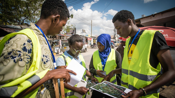
Two Hundred Subwards of Dar es Salaam to be Mapped by University Students in the Next Six Weeks
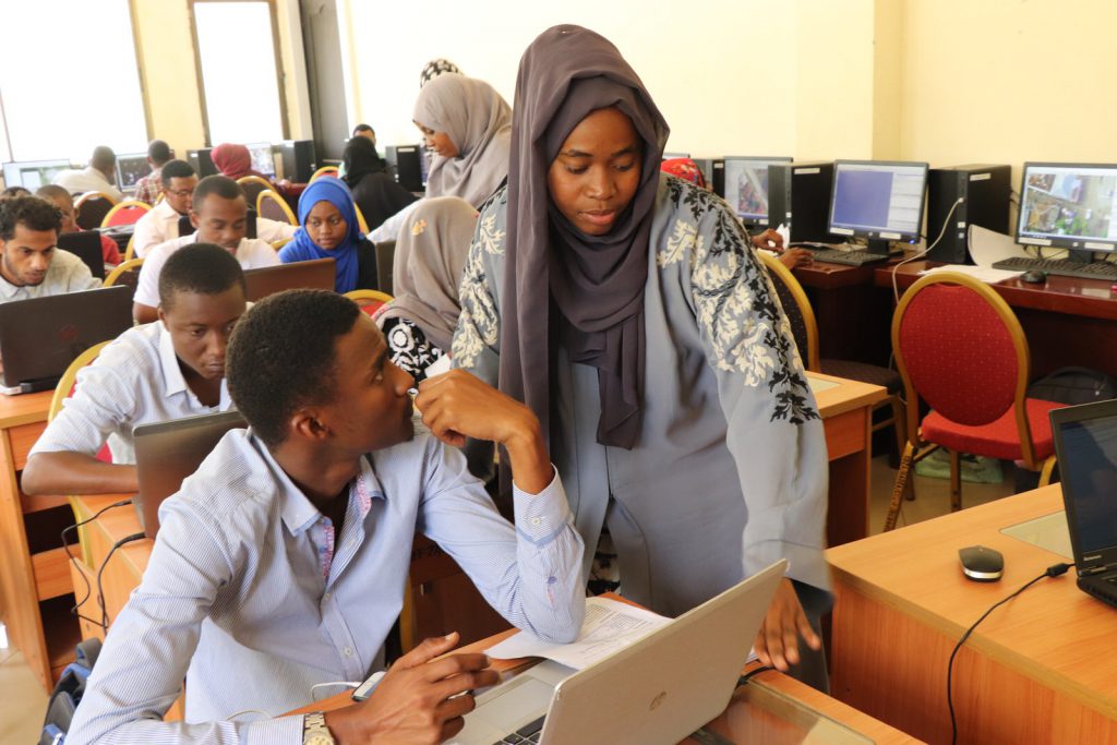
[:en]On the 23rd of July 2018, Humanitarian Openstreetmap Team (HOT) began scaling up the World Bank funded Dar Ramani Huria project, training over 400 students who will map flood hazards in Dar es Salaam. This year Ramani Huria is working with students from the University of Dar es Salaam and Ardhi University, aiming to extend […]
Mapping for EBOLA in DRC Congo: Creating spatial data sets to help responders in the field
“These people have never been mapped, nobody has ever cared enough about them to even know where their house is. So these houses that you have been tracing today, is the first time that anyone has ever cared enough about those people in that distant part of the Congo enough to know where they live […]
First Impressions of Ramani Huria: the rise of the Community Mapper
[:en]Currently 70% of the infrastructure in Dar es Salaam is unplanned, meaning that structures are often built in flood areas and are not adequately built to cope with high waters. Often, even unplanned buildings that are relatively ‘safe’ from flooding have huge consequences on the surrounding area; improper planning has led to an increase of […]
Using Drone Imagery to Generate Flood Inundation Models
Dar es Salaam is the largest city of Tanzania, it has an estimated 5.5 million residents and is also an economic centre for Tanzania and East Africa. Offset with this economic and social importance, Dar es Salaam has a tropical climate, experiencing two rainy seasons in a year (April – May and November – December). These seasons are usually accompanied with high rainfall, with high potential for flooding.
Installing a 3D Printing Weather Station in Tandale
Accurate and precise weather information is critical to preparing for extreme weather events, such as flooding. In Tanzania, the weather forecasts are primarily conducted by the Tanzanian Meteorological Agency (TMA) and are available through their website. But, the forecasts are at a regional level, the question is, how can we get an understanding of weather at a local level?
Creating Worldpop Inasafe Integration
As part of procedures in preparing better plans and risk reductions against natural disasters, Disaster Managers need accurate population data for the affected area. This helps in many ways from determining the scale of the disaster, impact assessment and analysis to planning for disaster resilience.
Mapping Bicycle Routes During Dar es Salaam’s Cycle Caravan
Each year, 5th June marks World Environment Day, a day for raising global awareness to take positive environmental action to protect nature and the planet Earth.
How are the maps being used in the wards?
[:en]Guest post by Mercedes Hoffay, Master of Public Administration Candidate – Columbia University All policy students are obsessed with the effectiveness and feasibility of policies and programs that governments implement. So when we find a tool that allows significant efficiency gains in government planning, we are thrilled. That is how we felt when we embarked […]
Community mapping presented to UDSM Masters students
[:en]Ramani Huria was excited to be invited by the University of Dar es Salaam (UDSM) to present on digital community mapping to GIS Masters students on 29th of February, 2016. The session was facilitated by Dr. Festus Ndumbaro, university lecturer on Cartography and GeoVisualization. Ramani Huria presented on ‘Web Maps’ and led a discussion with […]