
Unguja is one of the major islands in the archipelago of Zanzibar. Zanzibar is an island state that is part of the United Republic of Tanzania and has its own autonomous system of land administration.
Starting in 2003, the Finnish Government provided financial support to the government of Zanzibar for the implementation of the Sustainable Management of Land and Environment (SMOLE) project. One of the initiatives within this project involved the creation of new digital topographic maps for the Zanzibar archipelago. Before 2004, the latest topographic maps of Unguja were produced in the 80’s and they were still in use, for example, when researching infrastructure networks. However, significant changes in land use had taken place in the area, for example due to rapid urbanization and environmental changes so the previous map contained outdated data regarding the road infrastructure in the area. Aerial photographs for both the main islands, Unguja and Pemba, along with their 52 smaller islets were produced at the time for creating a new road map in 2004.
Humid tropical climates tend to have a dense cloud cover most of the time, and this is the case with Zanzibar. Thus taking clear aerial photos of Zanzibar is particularly challenging as clouds weaken the visibility from a bird’s-eye view. However, as good aerial photographs as possible were produced for both Unguja and Pemba with the help of a low-flying airplane. This process was gradual and took about a year. Subsequently photogrammetry stations and GIS (geoinformatics information system) software were used in digitizing the most important characters from the aerial pictures into informative and useful maps. This is how the Unguja road dataset was made.
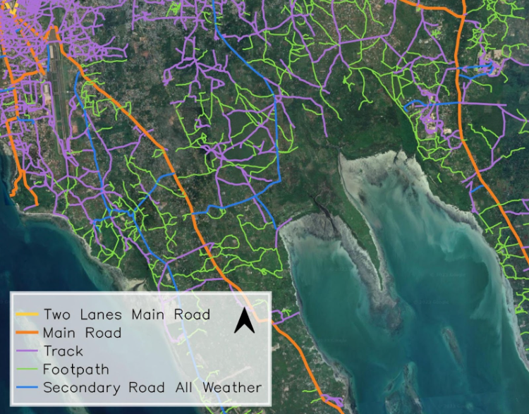
By comparing the 2004 dataset with the data produced in the 1980’s and the current road data from the area, you can get interesting information about changes in road infrastructure in Unguja over a period of forty years. This information could be used, for example, for research purposes.